IT Company Bremen 3D Graphics eLearning Software accessibility apps Image recognition Vision machine Software from Bremen Live streaming Process visualization Artificial intelligence (AI) Gesture recognition Native App Motion Capture Video server 3D Graphics eLearning Software Arduino Geometry recognition Software Bremen driver assistance Internet of Things IT Bremen Embedded software ARM Boards C++ programming 3D Visualization Industrial image processing QT programming Software developer C# programming linux embedded Visualization software QT development calibration procedure Android Apps iOS Apps IOT Software development IT Company Bremen 3D Graphics 3D image recognition accessibility apps Image recognition Motion Capture Video server 3D Graphics eLearning Software accessibility apps neural networks Image recognition Motion Capture Robotic automation Geometry recognition Software Bremen driver assistance IT consulting IT Company Bremen 3D Graphics eLearning Software accessibility apps Image recognition Vision machine Software from Bremen Live streaming Process visualization Speech recognition Gesture recognition Native App deep learning Motion Capture Video server 3D Graphics eLearning Software Face Factory Geometry recognition Software Bremen driver assistance Robotic automation big data Embedded software ARM Boards C++ programming 3D Visualization Industrial image processing QT programming Software developer C# programming accessibility apps Image recognition Vision machine Software from Bremen Live streaming Process visualization Speech recognition Gesture recognition Native App deep learning Motion Capture Video server 3D Graphics eLearning Software Face Factory Geometry recognition Software Bremen driver assistance Robotic automation big data Embedded software ARM Boards C++ programming 3D Visualization Industrial image processing QT programming Software developer C# programming
Aerospace technology / Remote sensing
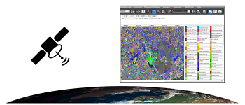
Derivation of geo-information from satellite data for specific applications and evaluation with modern procedures in digital image processing.

GedonSoft GmbH is your software partner for automatic evaluation with a user-friendly user interface to process satellite data.


The processes developed by us find application in:

- a navigation system in the aerospace industry

- change detection to make pedological changes visible by comparing multi-temporal image data

- remote sensing classification and segmentation

- development of algorithms for hydrological and pedological remote sensing through the evaluation of satellite-supported image data


Together with you, we analyze your requirements and support you efficiently and professionally in planning and implementing your project.

You’re interested in one of our services? We will gladly advise you!
Phone: +49421-2781835 or info@gedonsoft.de
MicroController mit Kommunikations-Anwendung
satellite-based remote sensing
MicroController-Anwendung
satellite navigation